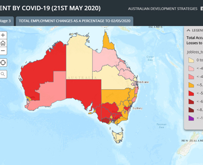
Impact on Australian Employment by COVID-19
Category:Health,Labour MarketWe trace the jobs impact of the Covid-19 labour market shutdown in a news article and a linked online story map published in The Australian today. The story outlines the evidence that the jobs downturn impacts announced by the Prime Minister in late March were sudden and deep and that since then, there have already